Featuring vibrant colours, a streamlined interface and combined coastal/inland content with a popular Navionics® style colour palette, Garmin Navionics+ cartography makes it easy to plot your course with the world’s No. 1 name in marine mapping.
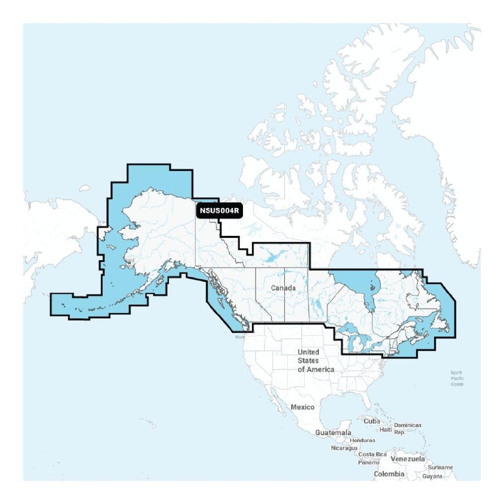
Canada and Alaska: lakes, rivers and coastal marine charts
See it your way: customize your view with various chart layers and overlay combinations
With your included one-year subscription, access daily updates via the ActiveCaptain® smart device app
Auto Guidance+™ technology lets you navigate with suggested dock-to-dock routings
Select up to 10 colour-shaded target depth ranges to scope out the best fishing spots
Access detail-rich mapping of coastal features, lakes, rivers and more
Charts are constantly being enhanced with new and amended content (as many as 5,000 updates are made every day)
Up to 1 ft. contours provide a clear depiction of bottom structure for improved fishing charts and enhanced detail in swamps, canals, harbours, marinas and more
Depth range shading
NOAA raster cartography is available as a free downloadable feature via the ActiveCaptain app to provide paper chart-like views on your plotter
ActiveCaptain community-sourced content provides useful POIs, such as marinas, anchorages, hazards, businesses and more
High-resolution relief shading feature combines colour and shadow to give you an easy-to-interpret, clearer view of bottom structure than contour lines alone
Sonar Imagery feature reveals bottom hardness clearly and in contrasting colour, highlighting both subtle and dramatic transition areas on select lakes
High-resolution satellite imagery provides superior situational awareness
Crystal-clear aerial and surface photos of ports, marinas, bridges, docks, boat ramps, dams and navigational landmarks
Side-scan images capture submerged features such as fallen timber, fish attractors, wrecks, potential hazards and more
3D Fisheye view: this underwater perspective shows 3D representation of bottom and contours as seen from below the waterline
Adjust your maps to the lake’s current water levels to see if spots are accessible or too shallow to explore
Format: microSD™/SD™


Share:
Share on Facebook Share on Twitter Share on Pinterest Tell a friend