
Garmin
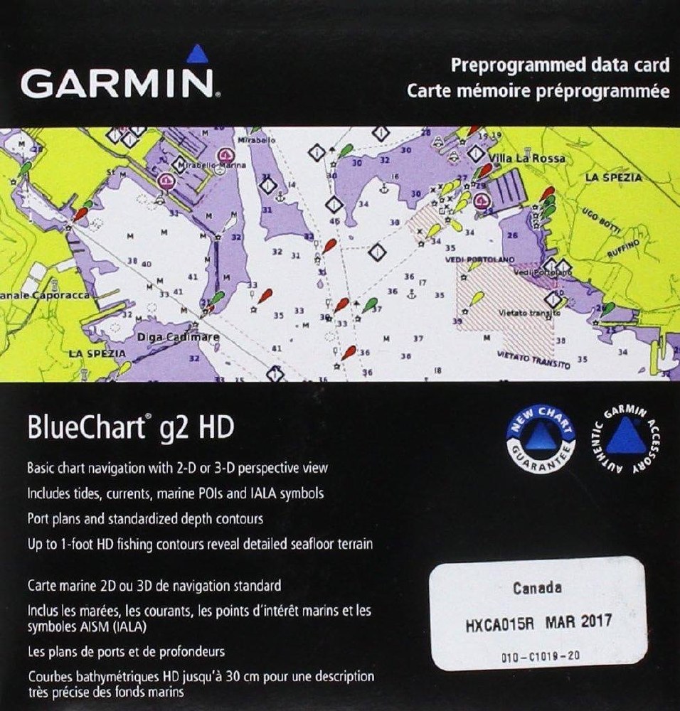
Garmin BlueChart g2
753759095758Unparalleled Coastal Chart Coverage
Provides exceptional coverage, clarity and detail with coastal charts that feature integrated Garmin and Navionics® data
Auto Guidance¹ technology calculates a route using your desired depth and overhead clearance and provides a suggested path to follow
Includes depth range shading for up to 10 depth ranges, enabling you to view your target depth at a glance
Up to 1’ contours provide a more accurate depiction of the bottom structure for improved fishing charts and navigation in swamps, canals and marinas
NOAA raster cartography² is available as a free downloadable feature via the ActiveCaptain® app
BlueChart g3 coastal charts provide industry-leading coverage, clarity and detail with integrated Garmin and Navionics data. Also included is Auto Guidance1 technology, which uses your desired depth and overhead clearance to calculate routes and provide a suggested path to follow — overlaid onto your chart. NOAA raster cartography is also available as a free downloadable feature via the ActiveCaptain app. It gives your chartplotter paper chartlike views of NOAA-surveyed areas in which individual points of interest are labeled with corresponding longitude and latitude information. Worldwide coverage is available by regions as accessory cards or via download; each region is sold separately.
Please check Compatible Models before purchase
Auto Guidance Technology
Whether you are fishing or cruising, select a spot, and get a route showing you the general path and nearby obstructions at a safe depth1.
Depth Range Shading
This feature displays high-resolution depth range shading for up to 10 depth ranges so you can view your designated target depth.
Shallow Water Shading
To aid in navigation, Shallow Water Shading allows map shading at a user-defined depth to give a clear picture of shallow waters.
Detailed contours
BlueChart g3 charts feature 30 cm (1 ft) contours that provide a more accurate depiction of bottom structure for improved fishing charts and enhanced detail in swamps, canals and port plans.
NOAA Raster Cartography
This feature gives your chartplotter paper chartlike views of NOAA-surveyed areas in which points of interest are labeled with corresponding longitude and latitude information.
1Auto Guidance is for planning purposes only and does not replace safe navigation practices. Auto Guidance is not included in preloaded BlueChart g3 for ECHOMAP™ Plus series chartplotters.
2Raster cartography cannot be viewed on echoMAP CHIRP and ECHOMAP Plus combos but can be viewed on mobile devices via the ActiveCaptain mobile app .
Retail Store
#8, 711 48th Ave SE,
Calgary, AB T2G 4X2
Store Hours
Mon-Fri: 9am - 5pm MST
Saturday: 9am - 2 pm MST
Sunday: CLOSED
Contact Us
Phone: 403-239-1400
Mon-Fri: 9am - 5pm MST
Saturday: 9am - 2pm MST
Email:
sales@gpscentral.ca
FAQs
Contact Us
About Us
About Us
Price & Customer Service Policy
Testimonials
Our Blog
Sign up for our Newsletter!
Shipping & Payments
Reviews
Customer Reviews
This product has not yet been reviewed.
Share:
Share on Facebook Share on Twitter Share on Pinterest Tell a friend